Our Services
Expert solutions for smart infrastructure projects.


GIS Solutions
Transforming data into actionable insights for projects.
Engineering Services
Delivering innovative engineering solutions for infrastructure.
GIS Solutions
At TERRA TECH, we believe progress never stops — every project we complete is a step toward building smarter, more sustainable infrastructure for the future.
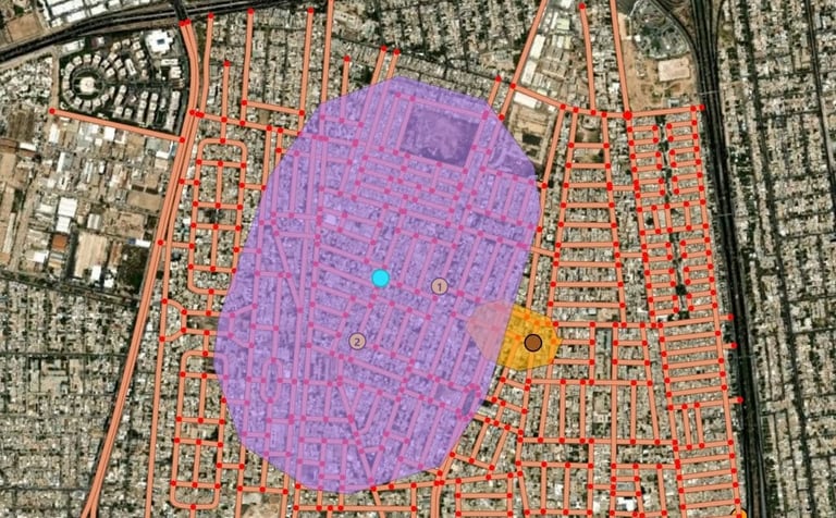
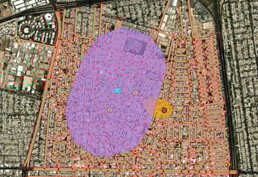
Geographic Information Systems (GIS)
Surveying and Geomatics
Building Information Modeling (BIM)


Information & Communication Technology (ICT)
Smart City Solutions
You didn’t come this far to stop
Digital Twin
Smart Infrastructure
Digital Mapping & CAD Design


Predict the future by creating it
Geographic Information Systems (GIS)
We provide integrated GIS solutions including spatial data analysis, geodatabase creation, and precise management of utility and infrastructure networks.
Our goal is to help organizations make smarter decisions through advanced mapping and geospatial analytics.
We offer land and marine surveying services using the latest measurement equipment and digital technologies to ensure the highest accuracy in planning and implementation.
Our services include topographic surveys, project layout, quantity calculation, and detailed field mapping.
We utilize BIM technology to integrate engineering designs with real-world data, reducing errors and enhancing collaboration between teams at every project stage — from design to execution and management.
Through BIM, we ensure better project quality, faster delivery, and a comprehensive digital vision of each project.
Surveying and Geomatics
Building Information Modeling (BIM)
Our Services
Predict the future by creating it
Digital Twin
We develop fully integrated digital replicas of real-world projects to enable intelligent monitoring and real-time performance analysis.
Digital Twin technology helps predict potential issues, improve operational efficiency, and support digital transformation in smart infrastructure projects.
We provide innovative solutions for managing electricity, gas, communication, and water networks using GIS and digital analysis technologies.
Our mission is to support digital transformation and build more sustainable, efficient, and connected cities through smart infrastructure systems.
We create precise engineering maps using AutoCAD and Civil 3D, seamlessly integrated with GIS systems to ensure full alignment between design and real-world implementation.
This service enhances project accuracy and enables efficient management of spatial and engineering data within a unified system.
Smart Infrastructure
Digital Mapping & CAD Design
Our Services
Accurate Bill of Quantities, Takeoffs, and Payment Certificates
Detailed quantity survey and payment statements — ensuring accuracy, transparency, and efficiency in every calculation.
Information & Communication Technology (ICT)
We provide integrated Information and Communication Technology (ICT) solutions to support infrastructure projects and digital transformation, including the planning, design, and implementation of telecommunications networks (FTTH / FTTX / Fiber Optic), as well as network documentation and database management, with full integration with Geographic Information Systems (GIS) to ensure high operational efficiency, data accuracy, and effective decision-making support.
FAQ
What is GIS?
GIS stands for Geographic Information Systems.
How does BIM help?
BIM enhances project visualization and collaboration.
What services do you offer?
We provide GIS, surveying, and engineering services.
We serve companies and government entities.
Who are your clients?
What is a digital twin?
A digital twin is a virtual model of a physical asset.

Contact
Get in touch with us today.